
What follows is the text of my presentation at the ICHC 2015 in Antwerp, held on July 15th. Abstract: That there exists a dialectical relationship between spatial representations and spatial practices is a familiar idea, which received extensive theoretical development by thinkers as diverse as Henri Lefebvre, Gunar Olsson or Franco Farinelli. My aim is […]
Category Archives: Maps
Wikitractatus spatial #2 – La fureur de lire

Après une première installation à Lausanne, le Wikitractatus a déployé ses branches sous le soleil de mai à Genève, à l’occasion de la Fureur de lire, adoptant deux formes, cette fois: une installation urbaine et un spectacle à trois voix. La performance s’est déroulée dans les combles du Collège Calvin du 16e s. Quand Genève […]
Wikitractatus spatial #1 – La Nuit de la lecture

Le Wikitractatus est un poème 2.0, dont le sens dépend de votre itinéraire, à l’instar du sens de n’importe quel territoire que vous créez par votre mouvement, par vos sensations, par les réflexions qui naissent en vous en marchant. Ce texte est né sur le papier il y a plus d’une dizaine d’années, comme une […]
La réalité c’est moi – power structures in the French Wikipedia
The word reality derives from the Latin res, the thing, but it is also related to réalité and roi, the kingliness of the king. What is real and what is real? That is the question when the reality of things becomes determined by their existence on the Internet. This existence, in turn, is subjected to […]
The impossible here
The recurring challenge facing anyone who tries to localize realities in order to show their spatial relations on a map is the systematic impermanence of any objectivized space. Thus any space used as a base layer in thematic maps must be thought of as the result of an ongoing production. Places, like any mobile individuals, […]
Age of Cosmologies
A cosmology is the science of the human position in what the Greeks called the cosmos: an ordered universe in space and time. The Greek word cosmos also means army. Even our physicists still conceive cosmoi, and make maps of them. One of these maps shows a universe unfolding in time like a living being. […]
Sunrise or Sunset? Per Capita GDP Evolution in EU Member States

The infographic above looks like a sunset or a sunrise rendered in an impressionist painting of the pixel age. It illustrates EU’s per capita domestic product from 1998 to 2011, expressed in “purchasing power standard” (PPS). To get the PPS, you divide the per capita GDP by the purchasing power parity index. It says, more […]
A mobility network
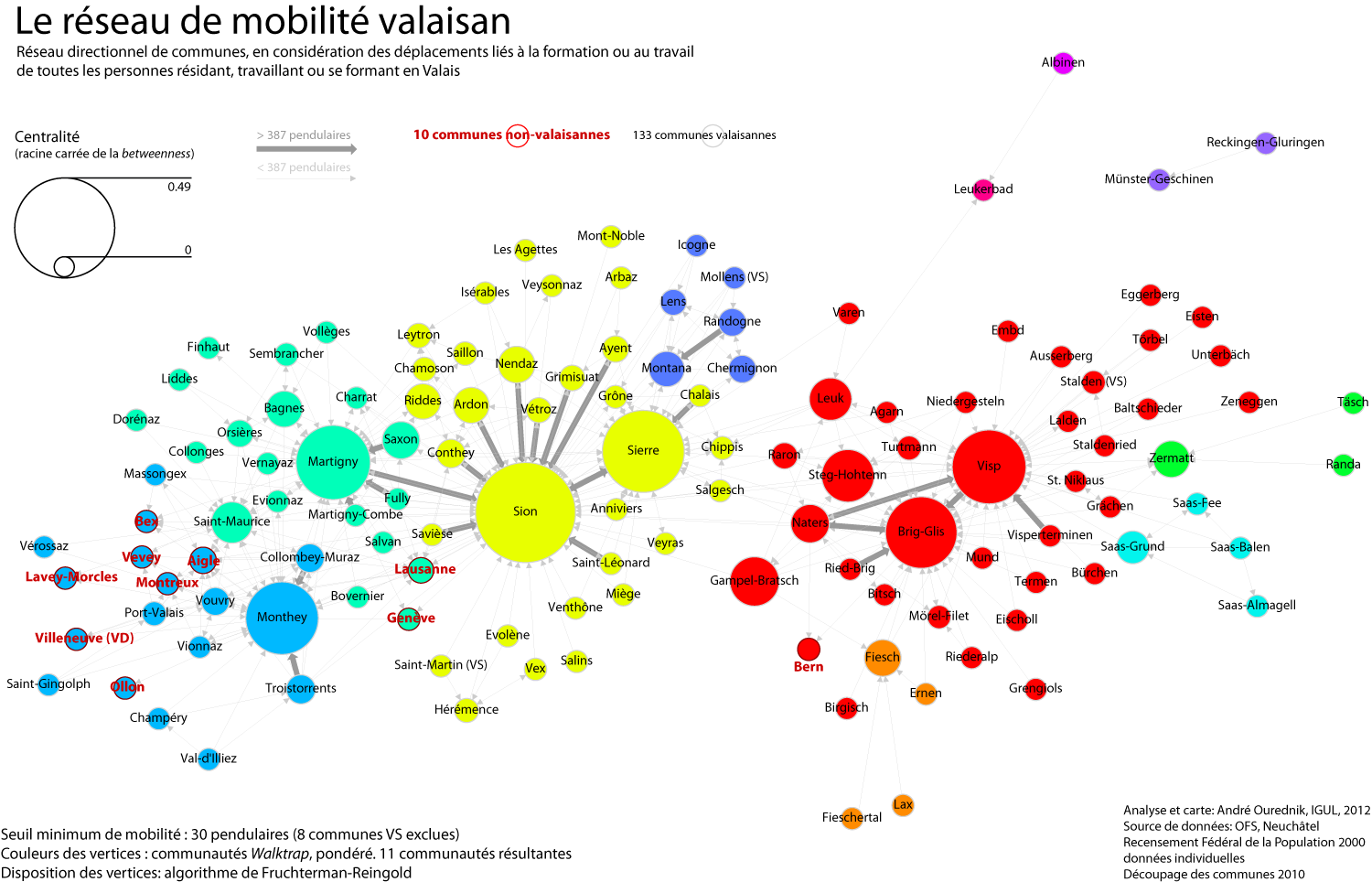
Methods and tools After a day and a half of work and fine-tuning, here we go: the commuting network of all individuals either residing, working or studying in the canton Valais. I’ve used R, with the RStudio GUI, and the igraph library for R. My staring point was the mobility matrix between all communes, including […]
Foucault’s left-overs and the urban heterostasis
Michel Foucault, in his 1984 essay Des espaces autres (Other Spaces), coins the term “hétérotopie”. He uses it to designate places evolving on the margin of what we could today call the territory of production. Foucault’s heterotopoi are cemeteries, brothels, prisons, boats, psychiatric hospitals… places inhabited by those who’ve either been excluded from society, or […]
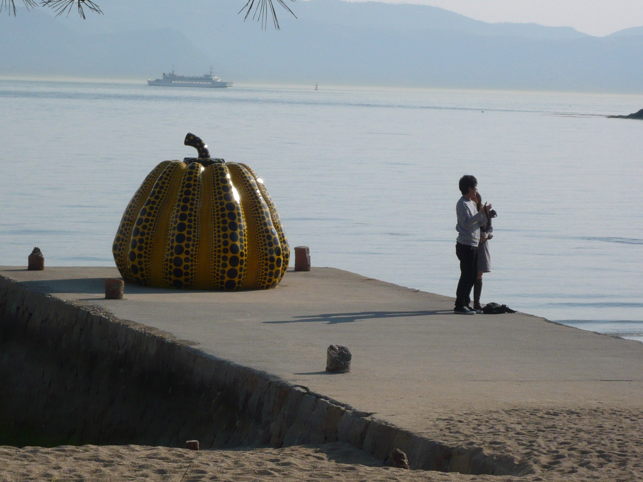
The tourist as the main inhabitant of a place
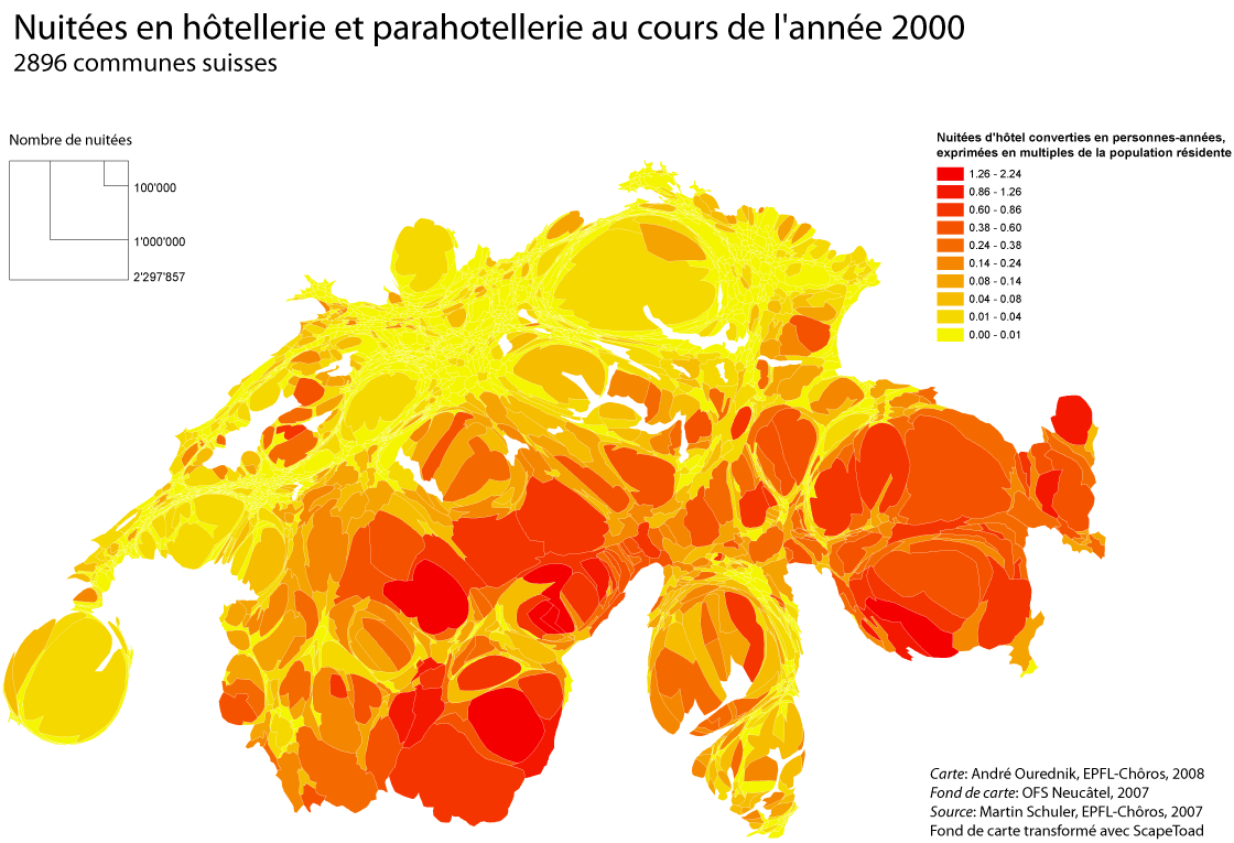
Who’s the real inhabitant of a place? For a long time, population maps have been constructed as if everybody stood still in their homes. Yet leaving this “domostatic” perspective is to geography like opening Pandora’s Box. All objects of any concern to the discipline must then be understood in a dynamic relationship to the rest […]