The infographic above looks like a sunset or a sunrise rendered in an impressionist painting of the pixel age. It illustrates EU’s per capita domestic product from 1998 to 2011, expressed in “purchasing power standard” (PPS). To get the PPS, you divide the per capita GDP by the purchasing power parity index. It says, more […]
Category Archives: Maps
A mobility network
Methods and tools After a day and a half of work and fine-tuning, here we go: the commuting network of all individuals either residing, working or studying in the canton Valais. I’ve used R, with the RStudio GUI, and the igraph library for R. My staring point was the mobility matrix between all communes, including […]
Foucault’s left-overs and the urban heterostasis
Michel Foucault, in his 1984 essay Des espaces autres (Other Spaces), coins the term “hétérotopie”. He uses it to designate places evolving on the margin of what we could today call the territory of production. Foucault’s heterotopoi are cemeteries, brothels, prisons, boats, psychiatric hospitals… places inhabited by those who’ve either been excluded from society, or […]
The tourist as the main inhabitant of a place
Who’s the real inhabitant of a place? For a long time, population maps have been constructed as if everybody stood still in their homes. Yet leaving this “domostatic” perspective is to geography like opening Pandora’s Box. All objects of any concern to the discipline must then be understood in a dynamic relationship to the rest […]
The Pope, Osama bin Laden and The Crucifix Map
Easter 2011 has been marked by a very particular conjunction of celebrations: the beatification of the body of the Pope John Paul II, preceded by its exhumation the capture and burial in deep sea of the body of Osama Bin Laden. John Paul II’s body has been moved to a marble stone monument in Pier […]
Paths in the green and spatial planning as a translation process
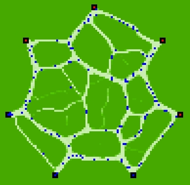
This map is an agent-based simulation result produced by NetLogo. It has been programmed years ago by a friend of mine, Alexios Kitsoupulos, from the University of Lausanne. What you see are paths produced in the green by people moving from one place to another. The basic rules are : – Individuals use existing paths […]
An autoportrait of a lived space
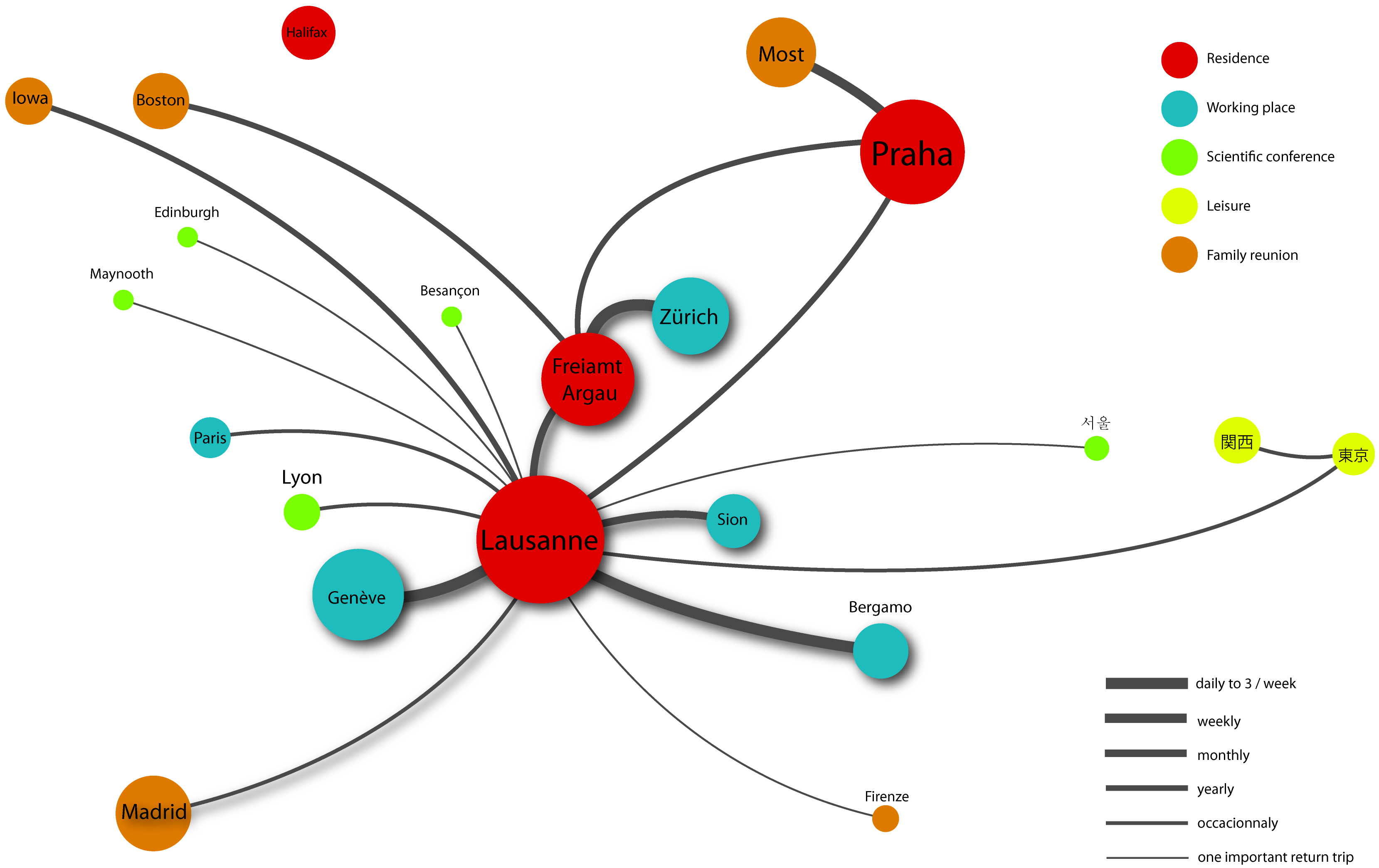
This is a map by which I’ve presented myself to my students on the first day in a course on tourism and mobility. I’ve given it in 2010 at the Università degli Studi di Bergamo. I wanted to make two points by showing it: What a professor teaches is deeply rooted in who he is. […]
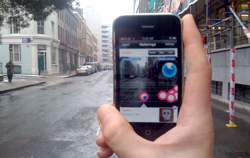
Augmented Reality and the Places of Dreams
Behind the illusion In Herzog’s Fitzcarraldo, Klaus Kinski with his eyes buried deep into another world stands on the shore of a river and says: Everyday life is only an illusion behind which lies the reality of dreams This is what the Jivaro Indians reportedly believe. But what Kinski’s character sees is his boat climbing […]
Representing a territory of mobile individuals by calculating total stay-times
Counting how many people reside at a given address might just not be enough to understand a territory of mobile individuals. Instead of counting people, I count their “stay-times”. In other words, I sum up the time spent by people in each place. The map above compares two results: Both ΣH and ΣT are calculated […]
Swiss Mobility in 2005
This map shows all movements made by Swiss citizens questioned on their traveling practices in the “Mikrozensus zum Verkehrsverhalten 2005“. 33’390 people have been asked. The map includes trips made for the purpose of work, study, leisure and household matters. Material infrastructures, like roads and railways, are shown too, in pink and red, but they […]