Deux modules R principaux servent aujourd’hui pour le traitement de données géomatiques: Pour comprendre ces modules R en détail, je vous recommande l’excellente documentation de Timothée Giraud & Hugues Pecout. Le présent exercice vise à vous familiariser avec les éléments de base de la cartographie vectorielle avec R. Le prérequis pour comprendre les instructions ci-dessous […]
Tag Archives: Switzerland
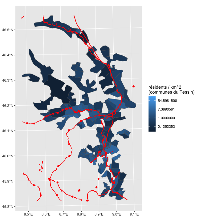
Cartographier des résultats de votations avec QGIS
Récupérer les fonds de carte Récupérez les limites communales généralisées sur le site de l’Office fédéral des statistiques en choisissant l’année correspondant à vos données. Pour cet exemple: 2016, respectivement du 30.01.2017 ou du 30.06.2015. Récupérez également les métainformations sur les géodonnées qui vous permettront de comprendre la signification des noms de fichiers et des […]
La Suisse, son passé, son futur et ses idées fixes… : le tube routier dupliqué du Gotthard
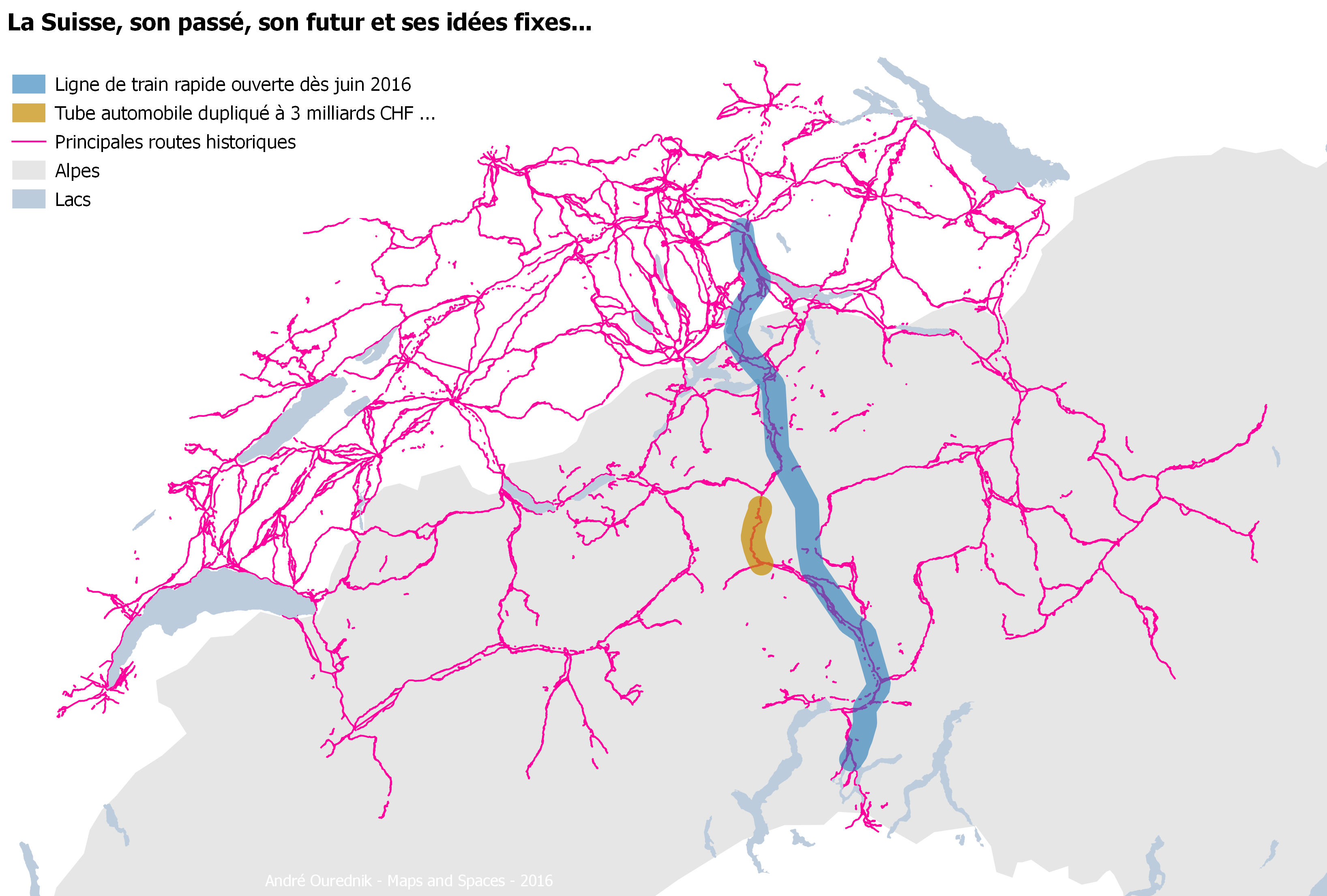
La nouvelle ligne de train CFF ouvre dès juin 2016. Sous le massif du Gotthard, nous voyagerons dans le plus long tunnel du Monde: un passage inédit à travers les Alpes. Et pourtant, d’aucuns s’obstinent à percer un tube pour voitures un peu plus à l’ouest – un second même, exactement parallèle au premier tube […]
Switzerland discusses food sovereignty – a vegetarian diet might be the answer
“Nothing will benefit human health and increase chances for survival of life on Earth as much as the evolution to a vegetarian diet”, said Albert Einstein. This might also the answer to the questions discussed this Wednesday, September 19th in the Swiss parliament (both in the Conseil National and in the Conseil des États). “Food […]
The tourist as the main inhabitant of a place
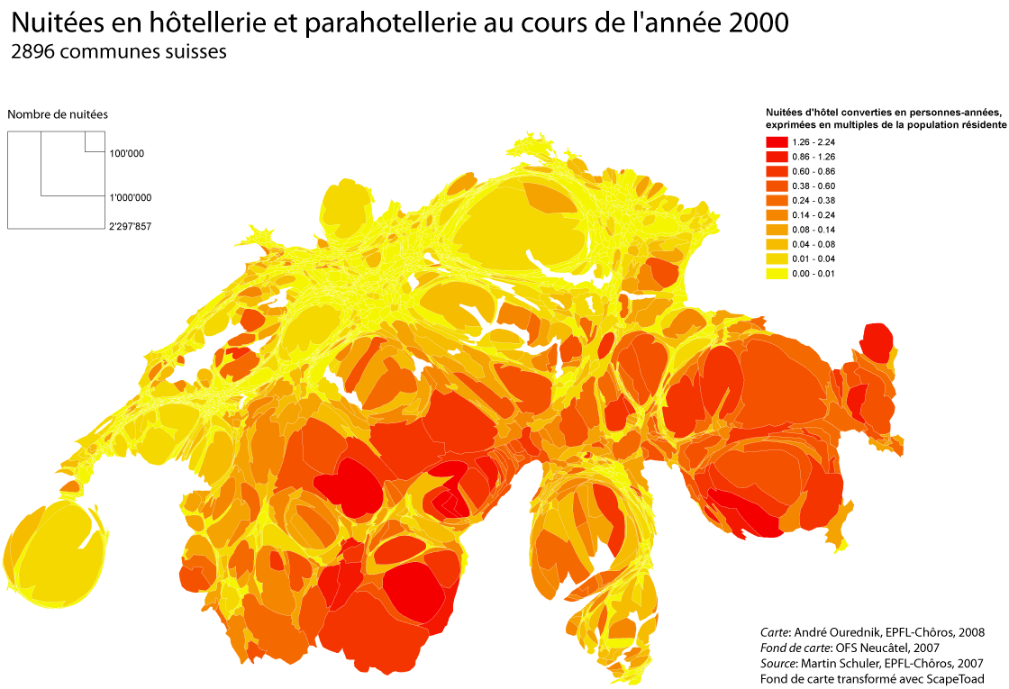
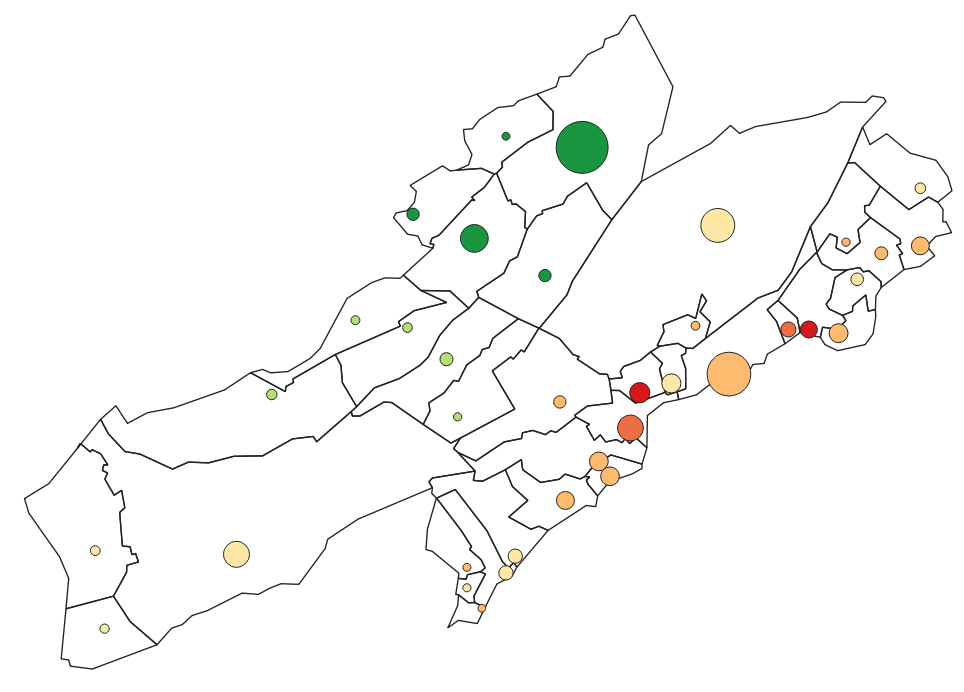
Who’s the real inhabitant of a place? For a long time, population maps have been constructed as if everybody stood still in their homes. Yet leaving this “domostatic” perspective is to geography like opening Pandora’s Box. All objects of any concern to the discipline must then be understood in a dynamic relationship to the rest […]
Representing a territory of mobile individuals by calculating total stay-times
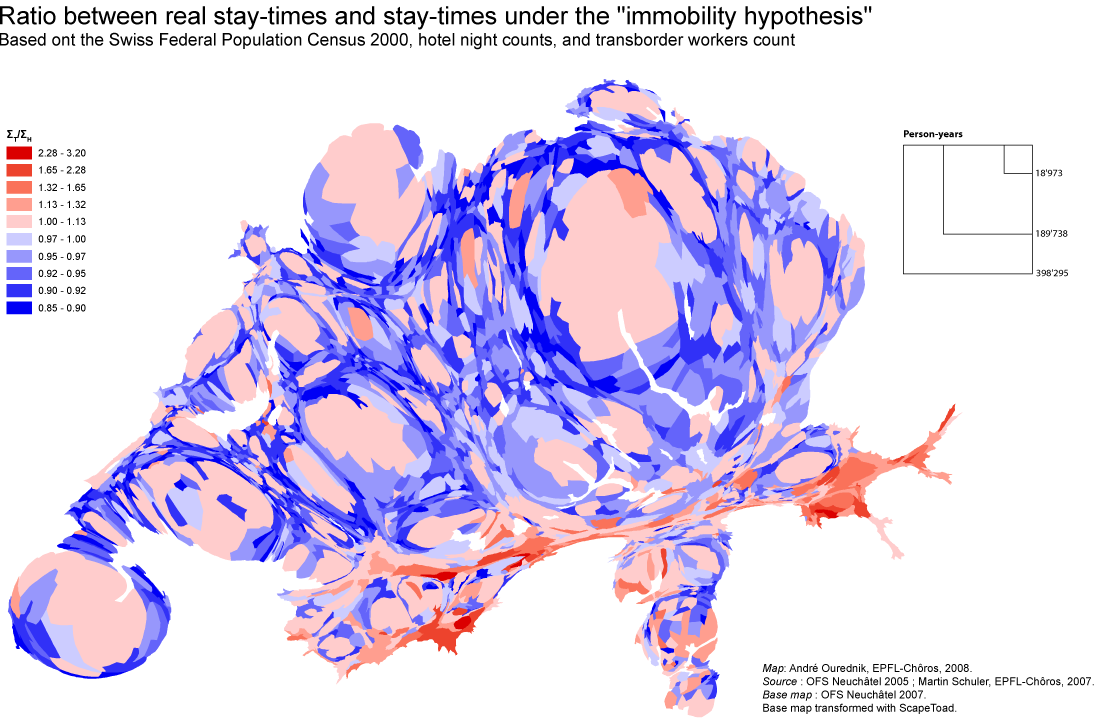
Counting how many people reside at a given address might just not be enough to understand a territory of mobile individuals. Instead of counting people, I count their “stay-times”. In other words, I sum up the time spent by people in each place. The map above compares two results: Both ΣH and ΣT are calculated […]
Swiss Mobility in 2005
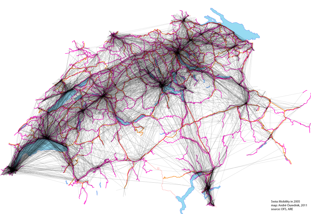
This map shows all movements made by Swiss citizens questioned on their traveling practices in the “Mikrozensus zum Verkehrsverhalten 2005“. 33’390 people have been asked. The map includes trips made for the purpose of work, study, leisure and household matters. Material infrastructures, like roads and railways, are shown too, in pink and red, but they […]