A peer-reviewed paper based on this short post is available here: Ourednik, A. (2017). The third dimension of political mapping: exploiting map interactivity for a better understanding of election and referendum results. Cartography and Geographic Information Science, 0(0), 1‑12. https://doi.org/10.1080/15230406.2017.1295820 On December 4th 2016, Austrians will have to renew their Bundespräsidentenwahl. Up to now, there […]
Tag Archives: demography
The tourist as the main inhabitant of a place
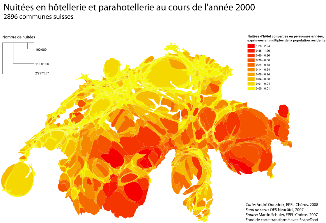
Who’s the real inhabitant of a place? For a long time, population maps have been constructed as if everybody stood still in their homes. Yet leaving this “domostatic” perspective is to geography like opening Pandora’s Box. All objects of any concern to the discipline must then be understood in a dynamic relationship to the rest […]
Representing a territory of mobile individuals by calculating total stay-times
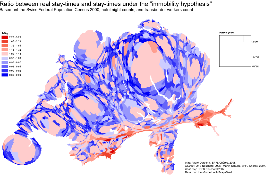
Counting how many people reside at a given address might just not be enough to understand a territory of mobile individuals. Instead of counting people, I count their “stay-times”. In other words, I sum up the time spent by people in each place. The map above compares two results: Both ΣH and ΣT are calculated […]