
GéoRécits allows you to map interviews pertaining to individuals’ mobility. You can compare individual travel journeys made by several individuals and leading to a common final destination – useful in the analysis of migrations – or analyse travel patterns accomlished for a given duration of time. The two functions of GéoRécits GéoRécits produces three types […]
Tag Archives: mobility network
A mobility network
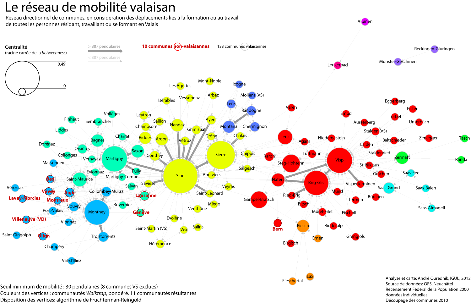
Methods and tools After a day and a half of work and fine-tuning, here we go: the commuting network of all individuals either residing, working or studying in the canton Valais. I’ve used R, with the RStudio GUI, and the igraph library for R. My staring point was the mobility matrix between all communes, including […]
Swiss Mobility in 2005
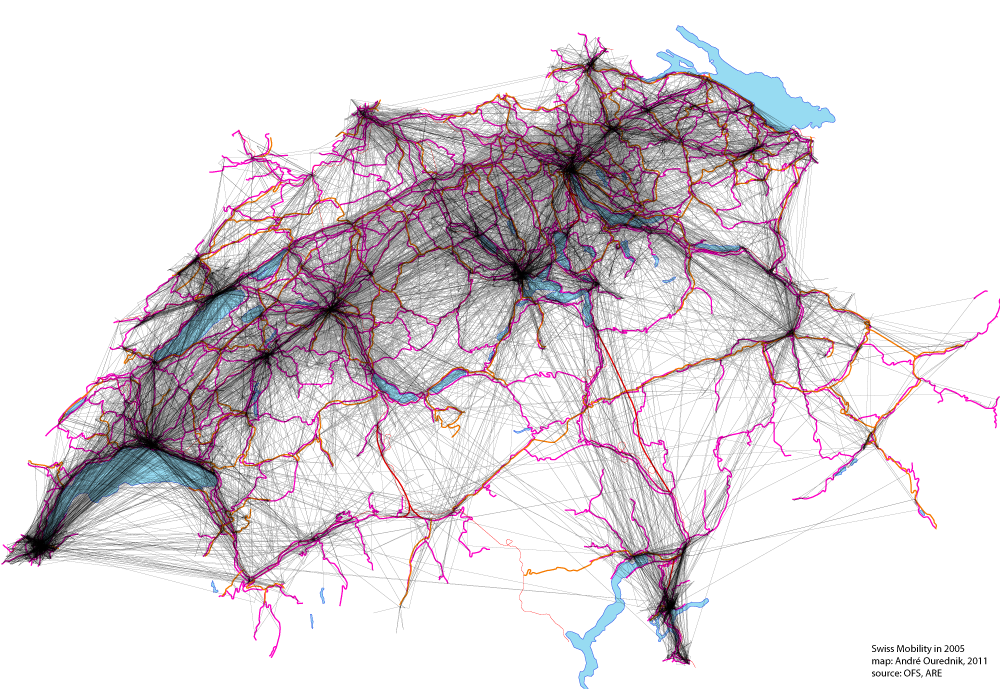
This map shows all movements made by Swiss citizens questioned on their traveling practices in the “Mikrozensus zum Verkehrsverhalten 2005“. 33’390 people have been asked. The map includes trips made for the purpose of work, study, leisure and household matters. Material infrastructures, like roads and railways, are shown too, in pink and red, but they […]