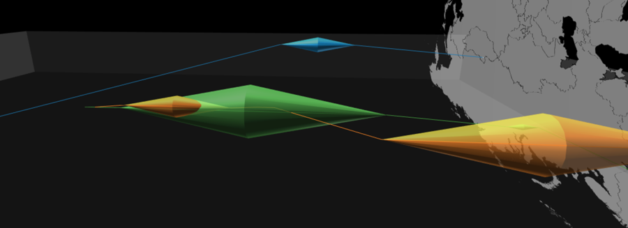
Spatial mobility always involves at least two types of distances: the topographical distance traveled on the surface of the Earth and the time distance taken to do so. GéoRécits3D allows you to map both in a “space-time aquarium” (a cuboid with one dimension dedicated to time). It is written using HTML5 and JavaScript, and uses […]
Tag Archives: time geography
GéoRécits – an application for mapping journeys and lived spaces

GéoRécits allows you to map interviews pertaining to individuals’ mobility. You can compare individual travel journeys made by several individuals and leading to a common final destination – useful in the analysis of migrations – or analyse travel patterns accomlished for a given duration of time. The two functions of GéoRécits GéoRécits produces three types […]