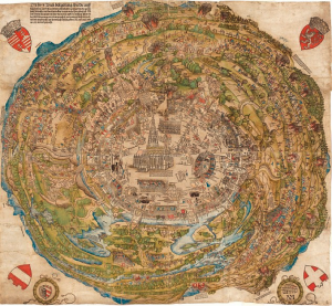
The recurring challenge facing anyone who tries to localize realities in order to show their spatial relations on a map is the systematic impermanence of any objectivized space. Thus any space used as a base layer in thematic maps must be thought of as the result of an ongoing production. Places, like any mobile individuals, always move with respect to any given formalized space.
In this process, maps have a localization purpose which should be understood as a “here”-enhancement, i.e. an enhancement of the potential of our environment.
I argue that the static, zenithal-view map, which used to be an important instrument of such enhancement, it is being growingly replaced by mobile devices able to articulate local information (building facades, vehicles, QR tags, etc.) with spatial databases into a new hic et nunc. I suggest that that the very concept of the “geographical map” should evolve so as to refer precisely to this interactive system of spatial information.
Read more here: André Ourednik : The impossible here.
