The Third Dimension of Political Mapping: exploiting map interactivity for a better understanding of election and referendum results
|
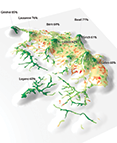
André Ourednik, 2017, « The Third Dimension of Political Mapping: exploiting map interactivity for a better understanding of election and referendum results », in Cartography and Geographic Information Science, volume 44, 2017. .abstract: Density-equalizing cartograms in the Euclidian plane are the usual cartographic solution for the discrepancy between the topographic nature of the GIS map, reflecting the extent of land surfaces, and the demographic nature of a vote, pertaining to the number of voters expressing a given political choice. Cartograms adapt map polygon areas to population sizes. Contemporary mapping technologies allow a different approach by giving access to interactive models in which the third dimension of space can be used to reflect a demographic variable while leaving the topographic base-map intact. This offers an answer to concerns about cartogram readability by the general public. Examples from Austrian election and Swiss referendum results are given to illustrate our approach. |