
Today, the United States are celebrating the 50th anniversary of John Glenn’s orbital flight: three tours of the globe in less than five hours. To mark the occasion, Craig Russell of Space Operations Inc., would have liked to see the mission replayed, but relying on private means only, this time. We get his point, because times have changed since […] Continue Reading…
Foucault’s left-overs and the urban heterostasis
Michel Foucault, in his 1984 essay Des espaces autres (Other Spaces), coins the term “hétérotopie”. He uses it to designate places evolving on the margin of what we could today call the territory of production. Foucault’s heterotopoi are cemeteries, brothels, prisons, boats, psychiatric hospitals… places inhabited by those who’ve either been excluded from society, or are no longer its […] Continue Reading…
Mars as a social question

“Allopatric speciation” occurs when a biological species divides in two distinct populations, due either to the emergence of a natural boundary (river, mountain) or to migration in opposite directions. Over hundreds of generations, the genotypes of both populations evolve on their own until, finally, they become two separate species.
For some species of fruit-flies, this operation takes but months. For […] Continue Reading…
Babylon and the City Recipe
Up to the beginning of the 20th century, the Ancient Testament had been the most cited text in societies with Christian heritage when it came to condemning the human hybris and its emblematic spatial figure: the city. Yet, quite surprisingly, the most anti-urban text contains the perfect set of ingredients to build one. As the prophets write, “behold”:
“The whole […] Continue Reading…
RStudio – one big step towards user-friendliness of R
R is the greatest open source statiscal programming package around. It is all a mapper need to pretreat data. Yet it suffers from interfaces that are either uggly, tedious to set up, clumsy to use or all of these. After years of glaring at the Windows interface of R, I’ve finally sutmbled upon a nice tool which takes seconds […] Continue Reading…
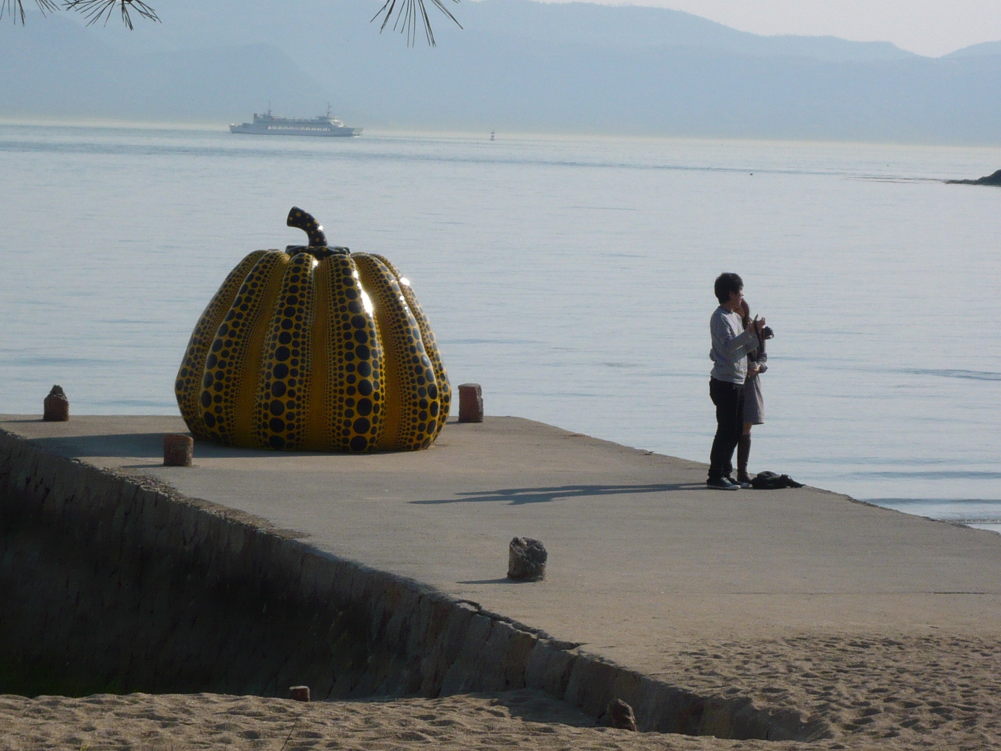
The tourist as the main inhabitant of a place

Hotel and para-hotel overnight stays in Switzerland in the year 2000. Total numbers and comparison do the residential stay-times.
Who’s the real inhabitant of a place? For a long time, population maps have been constructed as if everybody stood still in their homes. Yet leaving this “domostatic” perspective is to geography like opening Pandora’s Box. All objects of any concern […] Continue Reading…
The Pope, Osama bin Laden and The Crucifix Map
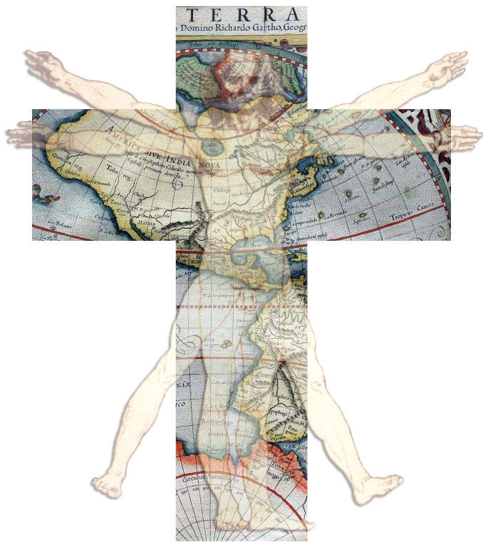
Easter 2011 has been marked by a very particular conjunction of celebrations:
the beatification of the body of the Pope John Paul II, preceded by its exhumationthe capture and burial in deep sea of the body of Osama Bin Laden.
John Paul II’s body has been moved to a marble stone monument in Pier Paolo Cristofari’s Chapel of St. Sebastian in […] Continue Reading…
Paths in the green and spatial planning as a translation process
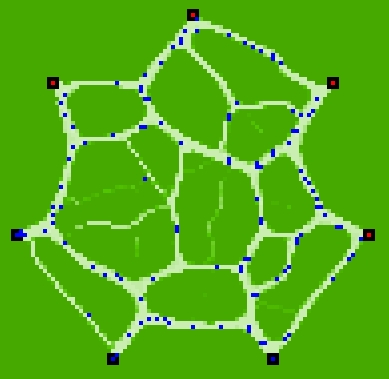
This map is an agent-based simulation result produced by NetLogo. It has been programmed years ago by a friend of mine, Alexios Kitsoupulos, from the University of Lausanne. What you see are paths produced in the green by people moving from one place to another. The basic rules are :
– Individuals use existing paths unless they diverge by more […] Continue Reading…
An autoportrait of a lived space
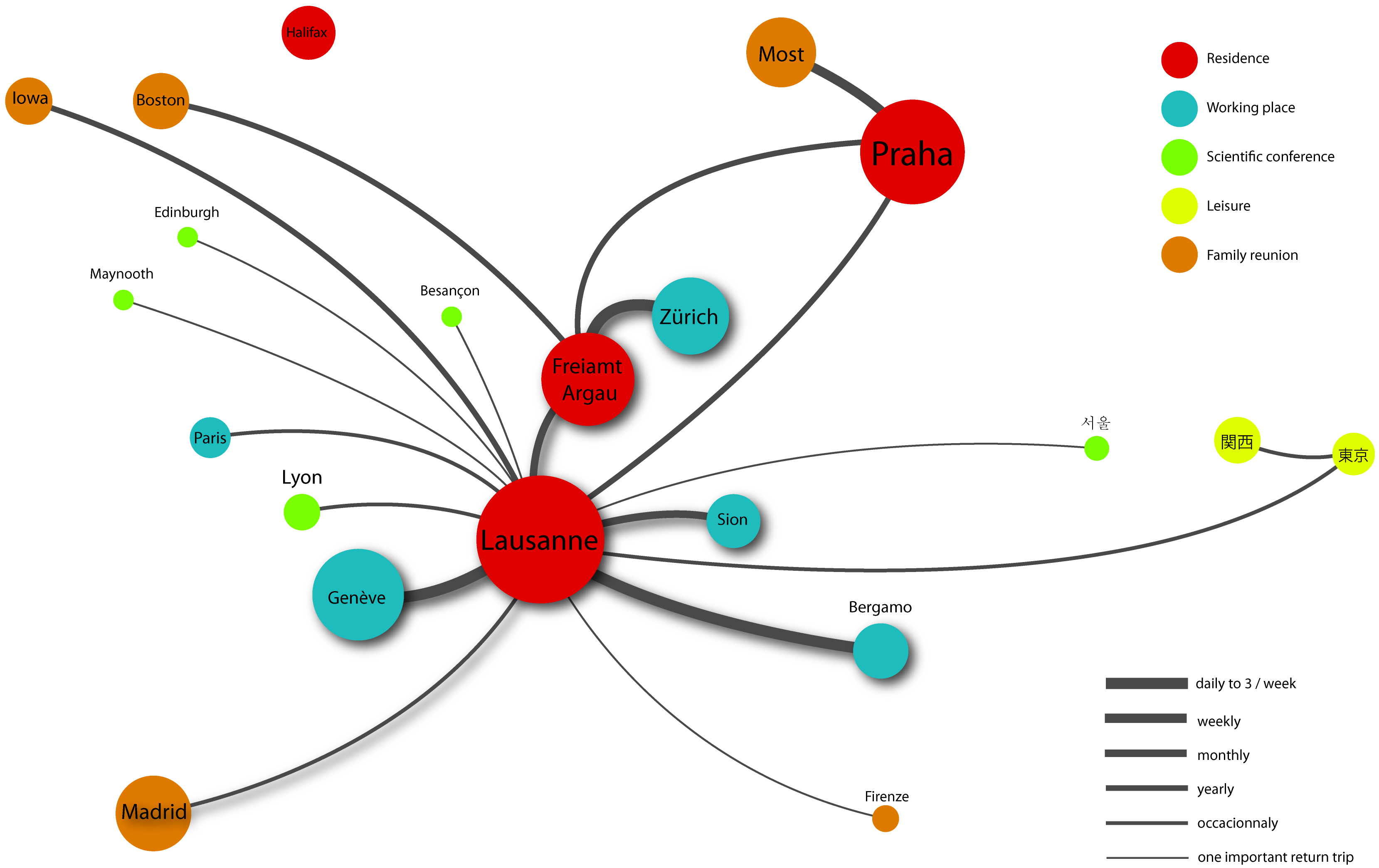
This is a map by which I’ve presented myself to my students on the first day in a course on tourism and mobility. I’ve given it in 2010 at the Università degli Studi di Bergamo. I wanted to make two points by showing it:
What a professor teaches is deeply rooted in who he is. You can only acquire […] Continue Reading…
Change the language to English/US on all slides and boxes in PowerPoint 2007 to 2016
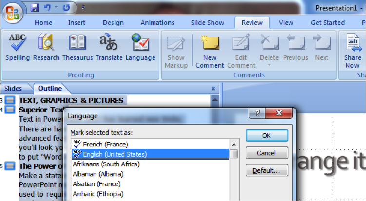
Changing the language of a whole presentation in MS PowerPoint can be tedious. Especially when you translate your slides. You easily end up with a mix of languages on a number of slides. You notice, then, that it is not possible to select the main one: the language button (on the bottom bar) is simply not clickable if a […] Continue Reading…