
Today, the United States are celebrating the 50th anniversary of John Glenn’s orbital flight: three tours of the globe in less than five hours. To mark the occasion, Craig Russell of Space Operations Inc., would have liked to see the mission replayed, but relying on private means only, this time. We get his point, because […]
Tag Archives: tourism
The tourist as the main inhabitant of a place
Who’s the real inhabitant of a place? For a long time, population maps have been constructed as if everybody stood still in their homes. Yet leaving this “domostatic” perspective is to geography like opening Pandora’s Box. All objects of any concern to the discipline must then be understood in a dynamic relationship to the rest […]
An autoportrait of a lived space
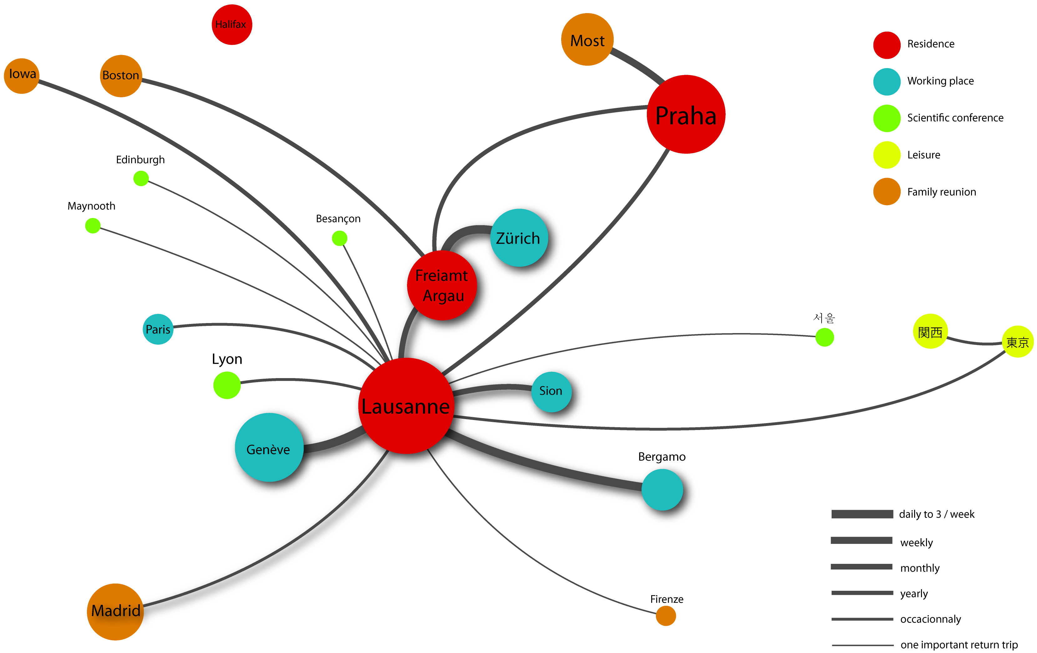
This is a map by which I’ve presented myself to my students on the first day in a course on tourism and mobility. I’ve given it in 2010 at the Università degli Studi di Bergamo. I wanted to make two points by showing it: What a professor teaches is deeply rooted in who he is. […]
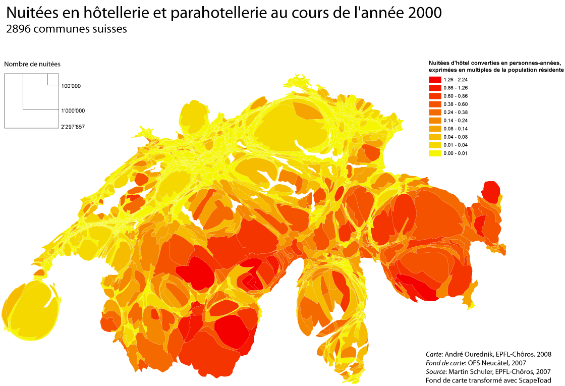
Representing a territory of mobile individuals by calculating total stay-times
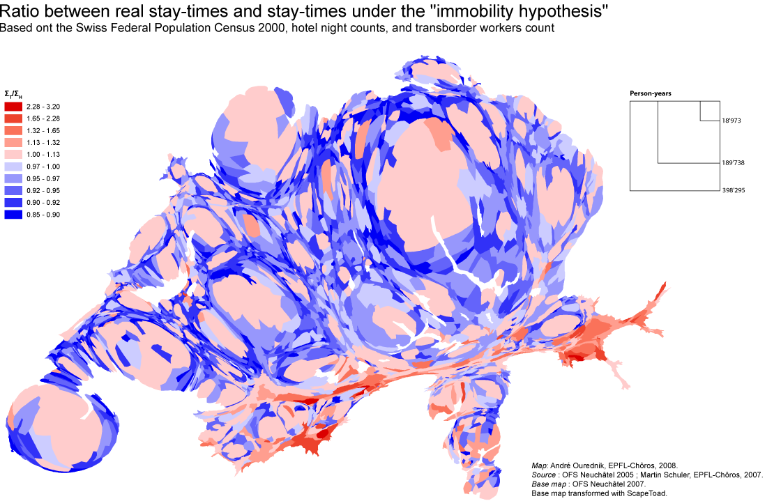
Counting how many people reside at a given address might just not be enough to understand a territory of mobile individuals. Instead of counting people, I count their “stay-times”. In other words, I sum up the time spent by people in each place. The map above compares two results: Both ΣH and ΣT are calculated […]
Swiss Mobility in 2005
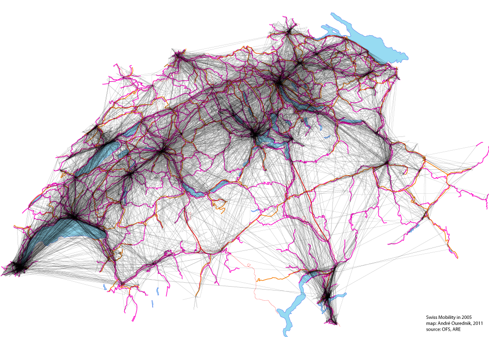
This map shows all movements made by Swiss citizens questioned on their traveling practices in the “Mikrozensus zum Verkehrsverhalten 2005“. 33’390 people have been asked. The map includes trips made for the purpose of work, study, leisure and household matters. Material infrastructures, like roads and railways, are shown too, in pink and red, but they […]