We’ve heared a lot about Wuhan (武汉), during 2020, for obvious reasons. Facts have a hard life on the battlefield of speculations, caught up in crossfire between pro-Trump propaganda channels (FoxNews, OANN, …) and Chinese state media. Scientists propose two hypotheses for the origin of the Covid-19:
- A zoonotic transmission from animal to human, traced back to the Huanan sea market. There seems to be a widespread consensus in favour of this hypothesis.
- An accidental escape from the Wuhan institute of virology.
The second hypothesis is to some degree a republican conspirationists’ overinterpretation of a scientific paper by Aline Chan, Shing Hei Zan and Benjamin E. Devermann. It is, however, also supported by the following observation:
[The institute’s scientists] have been discovering coronaviruses in bats in southern China and bringing them back to their lab in Wuhan. There, they mix genes from different strains of these novel viruses to test their infectivity in human cells and lab animals. When word spread in January that a novel coronavirus had caused an outbreak in Wuhan — which is a thousand miles from where the bats that carry this lineage of viruses are naturally found — many experts were quietly alarmed. There was no proof that the lab was the source of the virus, but the pieces fit.
– Rowan Jacobsen, “Could COVID-19 Have Escaped from a Lab?“, Boston, September 9th 2020
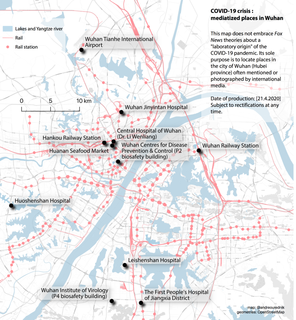
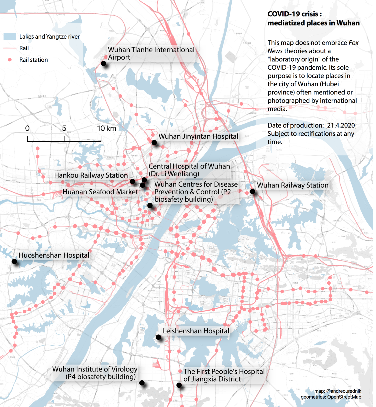
As a geographer and writer, I cannot forge a definite opinion about the subject. What hit me, though, was that no detailed map could be found of the city of Wuhan to visualise the relations between the places involved in any narrative of the emergence of Covid-19. Thus, in April 2020, I’ve produced the map below. A few days after publishing it, this whole site (ourednik.info) was banned from posting on Facebook. I have contacted the company to verify on what grounds, with no reply to this day. Since their platform ceased to be useful for sharing my content, I left it.
A map for multiple narratives
So let’s at least try to see where, in the city of Wuhan, are located the places everybody is writing about. The task isn’t evident, since mapping anything on the Chinese territory is illegal for foreigners and the GCJ-02 national system goes to great algorithmic lengths to distort location coordinates. Mapping Wuhan is thus prone to error, but let us try. My sources are Google Maps, Open Street Map, Wikipedia and https://tools.wmflabs.org
Some are contradictory. That something as factual and, in principle, easy to determine as geolocations should be subject to controversy was a negative surprise to me. It is all the more shameful as the lack of transparent data only nourishes conspiracy theories.

Information on these locations can be found with an internet search. I hope the algorithms of ecosia.org privilege reliable information:
- Central Hospital of Wuhan (Dr. Li Wenliang)
- Hankou Railway Station
- Huanan Seafood Market
- Huoshenshan Hospital
- Leishenshan Hospital
- The First People’s Hospital of Jiangxia District
- Wuhan Centres for Disease Prevention & Control (P2 biosafety level building)
- Wuhan Institute of Virology (P4 biosafety level building)
- Wuhan Jinyintan Hospital
- Wuhan Railway Station
- Wuhan Tianhe International Airport

you missed the main site of Wuhan Institute of Virology location CAS (Keji Road), District de Wuchang, Wuhan, Hubei, Chine (in front of the China Academy of Science), not on your map; (The lab P4 of WIV is at another location, and Jiangxia District, shown on your map). there are P3 lab on both locations.